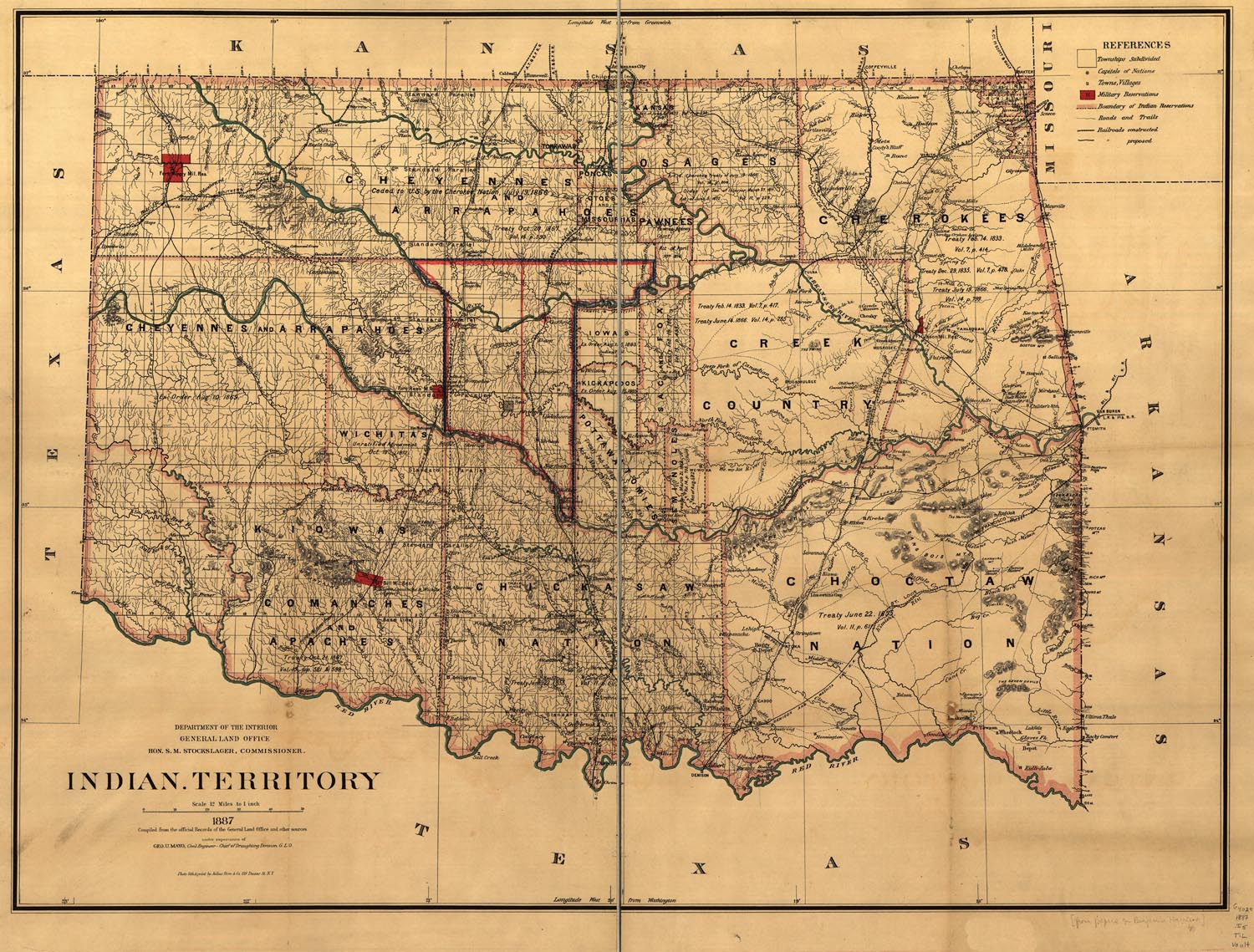
Map of the Indian Territory
|
|||
|
This Site:
|
|
||
|
|
|||
|
|
Site Copyright 2003-2018 Son of the South. For Questions or comments about this collection, contact paul@sonofthesouth.net |
||
Map of the Indian Territory
|
|||
|
This Site:
|
|
||
|
|
|||
|
|
Site Copyright 2003-2018 Son of the South. For Questions or comments about this collection, contact paul@sonofthesouth.net |
||