|
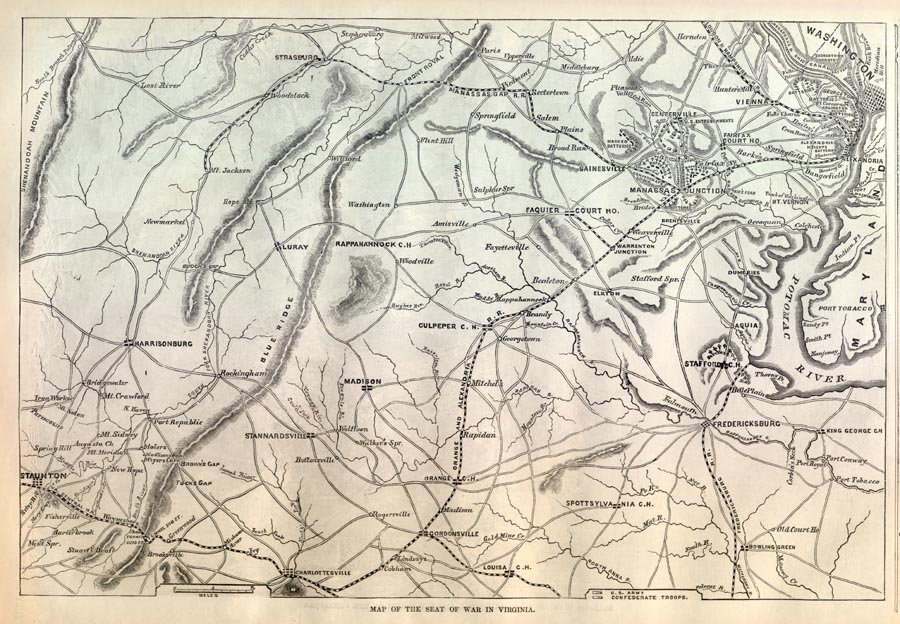
This is an
original Civil War Battle Map presenting details of the War in Virginia,
with a focus on the Battle of Bull Run (First Manassas). The map
was printed within days of the Battle of Bull Run, and shows incredible
detail of the geographic area of the time and key troop positions.
The map includes the areas around Madison, Harrisonburg, Staunton,
Spotsylvania, Fredericksburg, Stafford, Culpeper, Washington DC,
Centerville, and Manassas Junction. The locations of the Manassas Gap
Railroad as well as other railroads and roads in the area are shown.
The map includes the Blue Ridge Mountains, and other mountains in the
area. The
map shows the proximity of Bull Run to Washington DC, and you can
imagine the alarm that was generated that Rebel forces were fighting so
close to the capitol.
A note to our readers: This
original 140+ year old Bull Run Battle Map is available for $225.
We acquired it for the purpose of digitally archiving it for your
research and enjoyment. If you would like to purchase the map, the
proceeds will go to continuing to expand the free resources on this
site. If you are interested contact
paul@sonofthesouth.net . |