Map of Fort Clinton


This Site:

Discovery of America

The Explorers

Post Columbian Exploration

Thirteen Original Colonies

Colonization of America

Colonial Life

Colonial Days and Ways

Independence Movement

The Patriots

Prelude to War

Revolutionary War

Revolutionary War Battles

Overview of Revolutionary War

Revolutionary War Timeline


Civil War

American Flag

Mexican War

Republic of Texas

Indians

Map of Fort Clinton

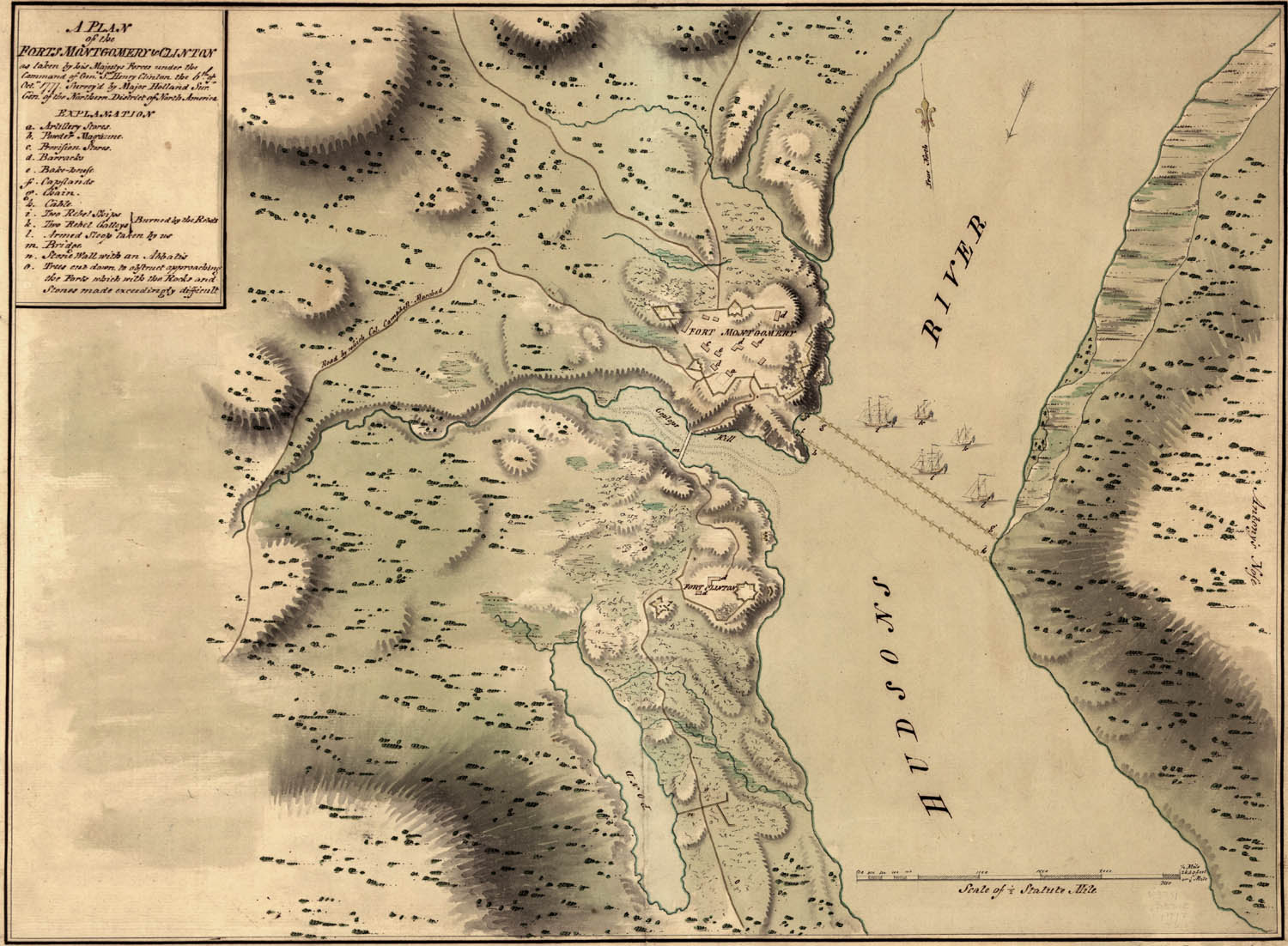
This is a nice map of the Battle for Fort Clinton during the Revolutionary War period. The map was created in 1777. The map shows a plan of the Forts Montgomery & Clinton as taken by His Majesty's forces under the command of General Sir Henry Clinton the Octover 6, 1777. Surveyed by Major Holland, surr. genl. of the Northern District of North America.

This is a truly historic map, and we are pleased to be able to offer Fine Art Prints of this map below. Each print is individually created by hand, and is produced to capture the tone and appearance of the original. This map would make a dramatic display when framed and placed in your office or study.


Fine Art Prints of this Original Fort Clinton Map

8X10 Fine Art Print: $35 + $4 Shipping

11X14 Fine Art Print: $50 + $6 Shipping

13X19 Fine Art Print: $65 + $7 Shipping

Shipping Charges Reflect Rates for Continental United States, email us for rates to other areas.


free web hit counter


Site Copyright 2003-2008 Son of the South. Fine Art Prints are available for most artwork on this site. For Questions or comments about this collection,

contact: paul@sonofthesouth.net

privacy policy

Are you Scared and Confused? Read My Snake Story, a story of hope and encouragement, to help you face your fears.