|
This Site:
Discovery of America
The Explorers
Post Columbian Exploration
Thirteen Original Colonies
Colonization of America
Colonial Life
Colonial Days and Ways
Independence Movement
The Patriots
Prelude to War
Revolutionary War
Revolutionary War Battles
Overview of Revolutionary War
Revolutionary War
Timeline
Civil War
American Flag
Mexican War
Republic of Texas
Indians
|
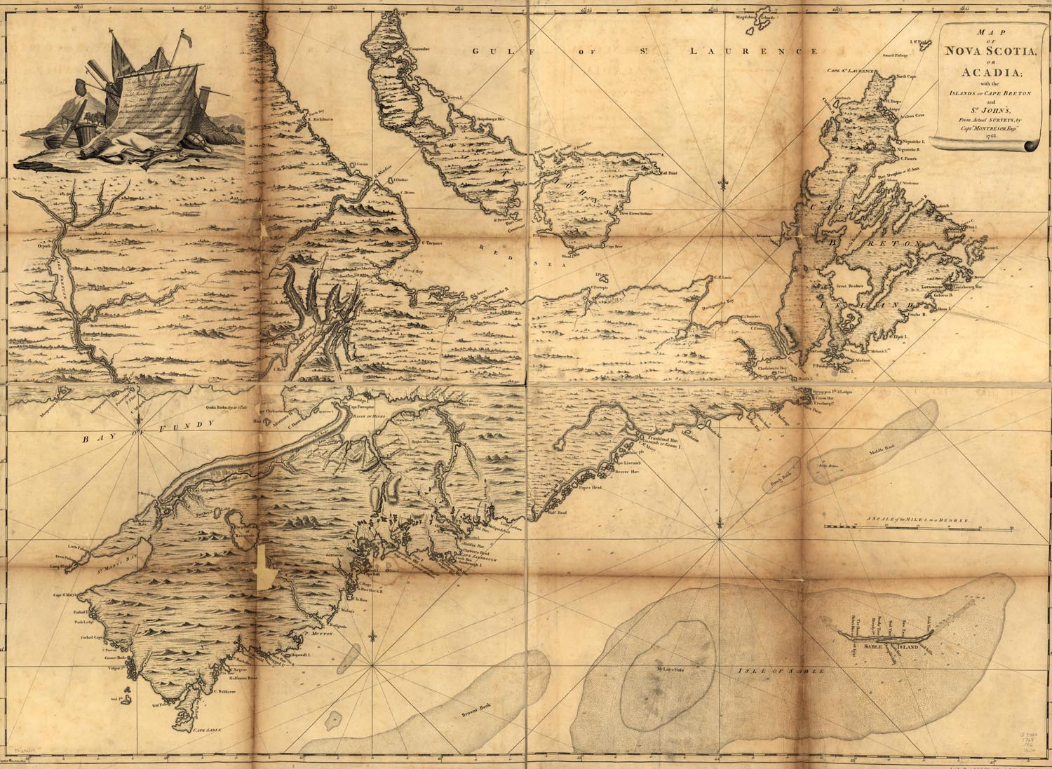
This is an original map created in 1768 which
shows Acadia in Colonial times. The map is labeled, "Map of
Nova Scotia, or Acadia; with the islands of Cape Breton and St.
John's, from actual surveys, by Captn. Montresor, engir., 1768" The map was created in London. It has incredible
detail on the terrain, rivers and streams, and towns at the time of
the Declaration of Independence, and the Revolutionary War.
|