Map of Fortifications of the Boston Neck


This Site:

Discovery of America

The Explorers

Post Columbian Exploration

Thirteen Original Colonies

Colonization of America

Colonial Life

Colonial Days and Ways

Independence Movement

The Patriots

Prelude to War

Revolutionary War

Revolutionary War Battles

Overview of Revolutionary War

Revolutionary War Timeline


Civil War

American Flag

Mexican War

Republic of Texas

Indians

Boston Neck Map

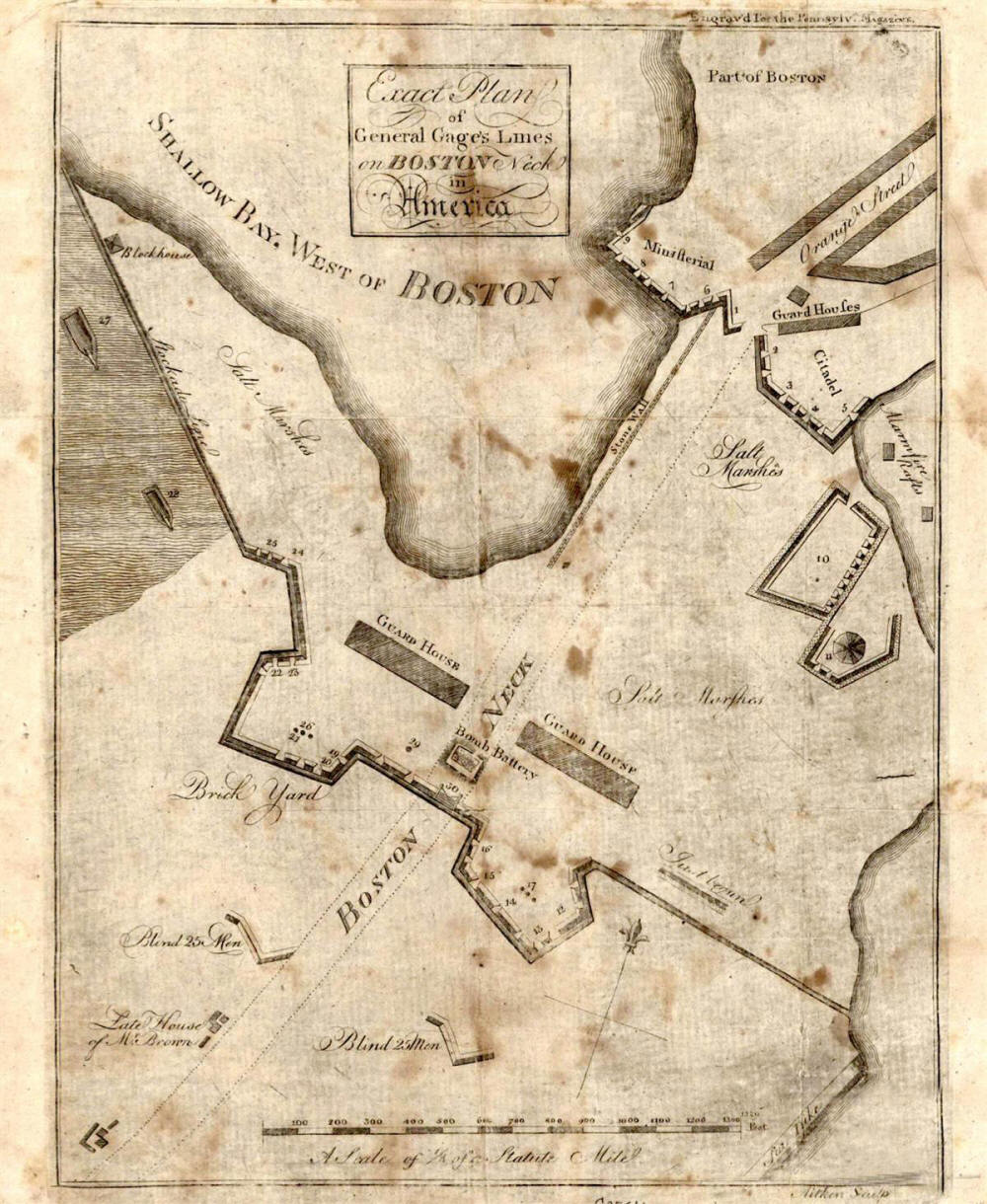
Map of the General Gage's Fortifications of Boston Neck

This is an original map created in 1775 which shows General Gage's Fortifications of Boston Neck. The map is titled, "Exact plan on General Gage's Lines on Boston Neck in America." The map was created in Philadelphia in 1775. The map was created for the Pennsylvania Magazine. This is an incredible piece, which shows important details of the area during the Revolutionary War period.

We are pleased to be able to offer Fine Art Prints of this incredible piece of American History. Each map in individually hand printed to capture the tone and feel of the original. It will make a stunning addition to any office or study.

Fine Art Print of Original Boston Neck Map

8X10 Fine Art Print: $35 + $4 Shipping

11X14 Fine Art Print: $60 + $6 Shipping

13X15 Fine Art Print: $85 + $7 Shipping


free web hit counter


Site Copyright 2003-2008 Son of the South. Fine Art Prints are available for most artwork on this site. For Questions or comments about this collection,

contact: paul@sonofthesouth.net

privacy policy

Are you Scared and Confused? Read My Snake Story, a story of hope and encouragement, to help you face your fears.