|
This Site:
Discovery of America
The Explorers
Post Columbian Exploration
Thirteen Original Colonies
Colonization of America
Colonial Life
Colonial Days and Ways
Independence Movement
The Patriots
Prelude to War
Revolutionary War
Revolutionary War Battles
Overview of Revolutionary War
Revolutionary War
Timeline
Civil War
American Flag
Mexican War
Republic of Texas
Indians
|
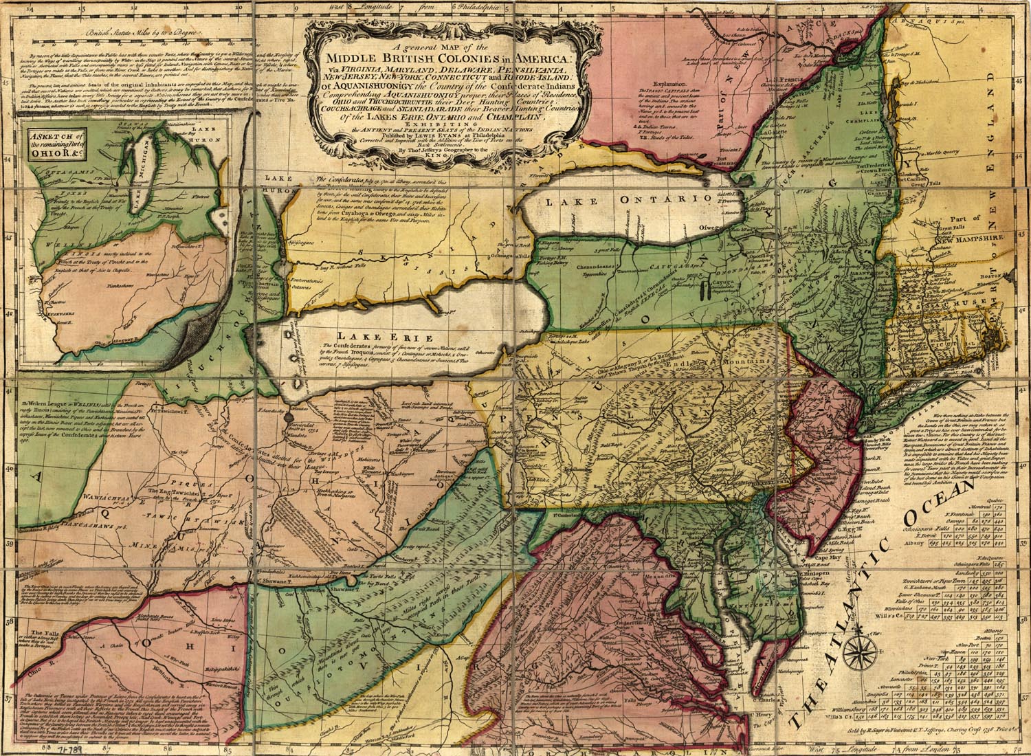
Map of Colonial Virginia
This is an original map created in 1758 which
shows the thirteen original colonies, including colonial Virginia.
Virginia is the red and yellow region on the lower portion of the
map. The map shows the terrain, rivers, towns and villages in the
area in colonial times.
The map was made at a time when tensions between
the Colonies and England were running very high. The map has this
interesting note on it:
"Were there nothing at stake between the crown
of Great Britain and France but the Lands of the Ohio, we may
reckon it as a great Prize as has ever been contended for
between two Nations. For this Country is of that vast Extent
Westward as to exceed in good Land all the European Dominions of
Great Britain, France, and Spain, which are almost destitute of
Inhabitants. It is impossible to conceive that had his Majesty
been made Acquainted with its value and great importance, the
large strides the French have been making for several Years past
in their encroachments on his Dominions that his Majesty
would sacrifice one of the best Gems in his Crown to their
Usurpation and Boundless Ambition"
The map includes a view of Virginia,
Maryland,
Delaware,
Pennsylvania,
New Jersey,
New York,
Connecticut, and
Rhode
Island: Of Aquanishuonigy the country of the Confederate Indians
comprehending Aquanishuonigy proper, their places of residence, Ohio
and Tuchsochruntie their deer hunting countries, Couchsachrage and
Skaniadarade, their beaver hunting countries, of the Lakes Erie,
Ontario, and Champlain, ... exhibiting the antient and present seats
of the Indian nations. Published by Lewis Evans at Philadelphia;
corrected and improved with the addition of the line of forts on the
back settlements, by Thomas Jefferys.
|