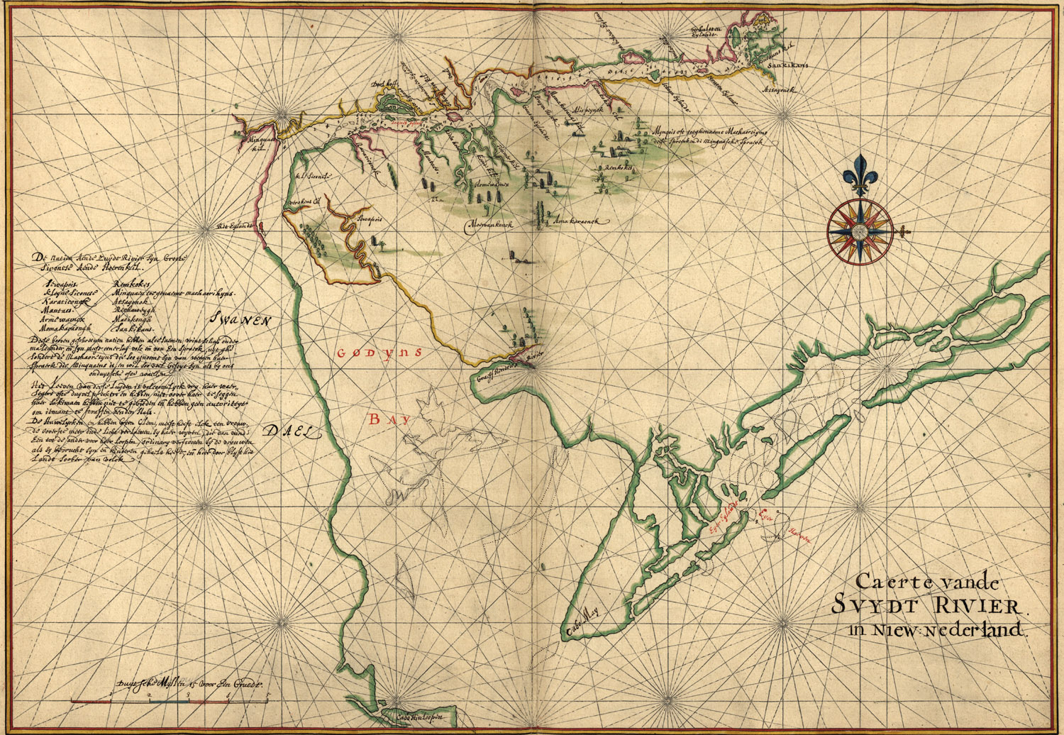
Map of Delaware Bay


This Site:

Discovery of America

The Explorers

Post Columbian Exploration

Thirteen Original Colonies

Colonization of America

Colonial Life

Colonial Days and Ways

Independence Movement

The Patriots

Prelude to War

Revolutionary War

Revolutionary War Battles

Overview of Revolutionary War

Revolutionary War Timeline


Civil War

American Flag

Mexican War

Republic of Texas

Indians

Delaware Bay Map

Map of Delaware Bay in 1639

This is an original map of Delaware Bay created in 1639. The map is labeled, "Caert vande Svydt Rivier in Niew Nederland." It shows the region of the Delaware Bay and river, natural features, and other geographical entities. It is attributed to Joan Vinckeboons by comparison with his other Dutch maps in Henry Harrisse collection.

We are pleased to be able to offer Fine Art Prints of this incredible piece of Delaware History. Each map in individually hand printed to capture the tone and feel of the original. It will make a stunning addition to any office or study.

Fine Art Print of Original Colonial Delaware Bay Map

8X10 Fine Art Print: $35 + $4 Shipping

11X14 Fine Art Print: $60 + $6 Shipping

13X19 Fine Art Print: $85 + $7 Shipping


free web hit counter


Site Copyright 2003-2008 Son of the South. Fine Art Prints are available for most artwork on this site. For Questions or comments about this collection,

contact: paul@sonofthesouth.net

privacy policy

Are you Scared and Confused? Read My Snake Story, a story of hope and encouragement, to help you face your fears.