|
This Site:
Discovery of America
The Explorers
Post Columbian Exploration
Thirteen Original Colonies
Colonization of America
Colonial Life
Colonial Days and Ways
Independence Movement
The Patriots
Prelude to War
Revolutionary War
Revolutionary War Battles
Overview of Revolutionary War
Revolutionary War
Timeline
Civil War
American Flag
Mexican War
Republic of Texas
Indians
|
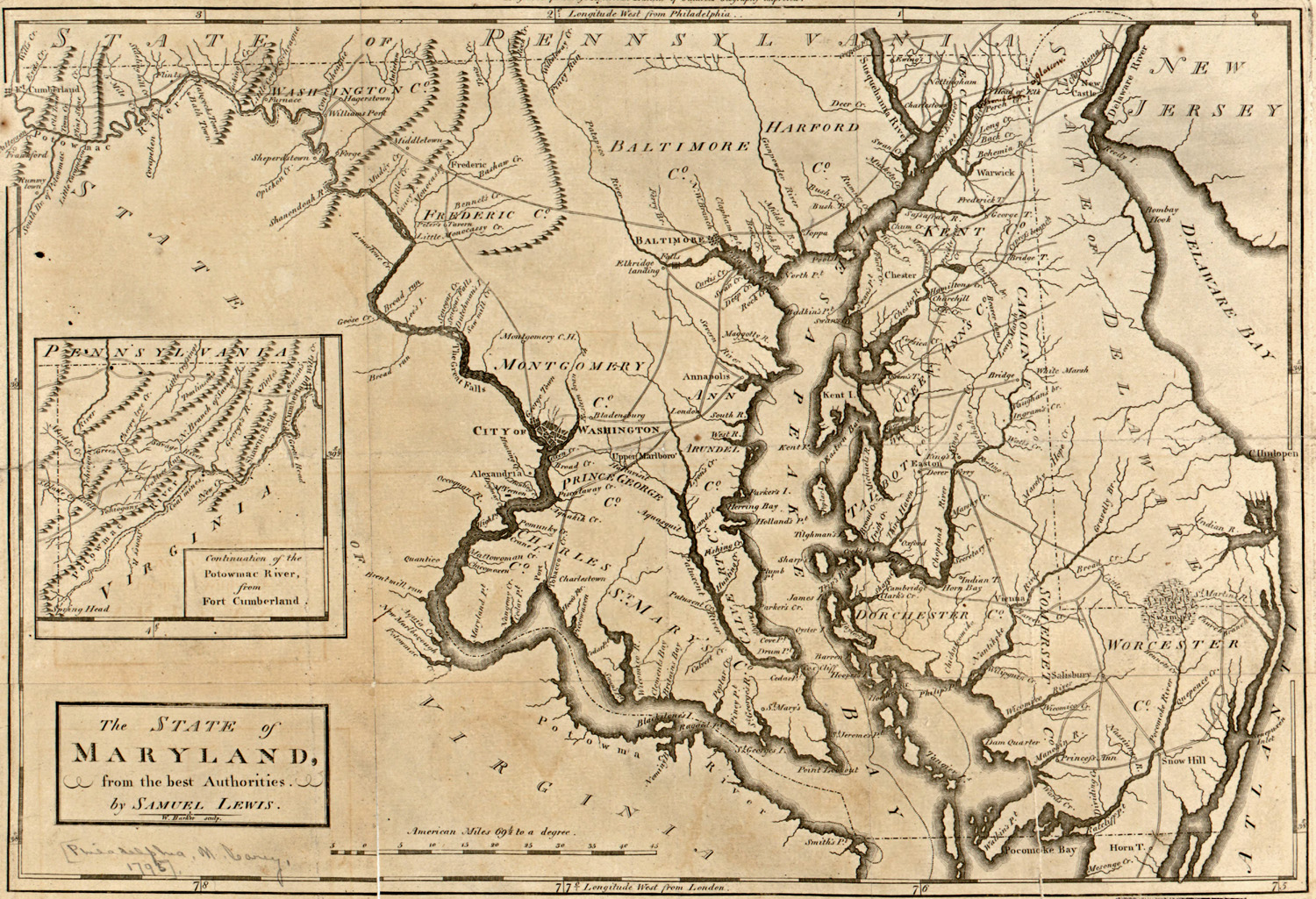
Map of Maryland
During the Revolutionary War
This is an original map created in 1775 which
shows Maryland and the surrounding area. The map is titled, "The
State of Maryland from the best authorities. By Samuel Lewis. W.
Barker, sculp." It has the inset illustration, "Continuation of the
Potowmac River, from Fort Cumberland." Engraved for Carey's American
edition of Guthrie's Geography improved.
|