|
This Site:
Discovery of America
The Explorers
Post Columbian Exploration
Thirteen Original Colonies
Colonization of America
Colonial Life
Colonial Days and Ways
Independence Movement
The Patriots
Prelude to War
Revolutionary War
Revolutionary War Battles
Overview of Revolutionary War
Revolutionary War
Timeline
Civil War
American Flag
Mexican War
Republic of Texas
Indians
|
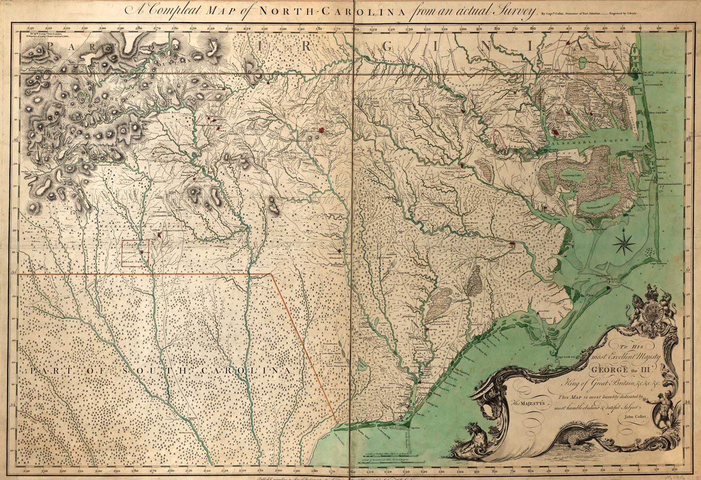
Map of the North Carolina Colony
This is an original map created in 1770, showing
the North Carolina Colony. The map is titled, "Complete map of
North-Carolina from an actual survey / by Captain Collet, Governor
of Fort Johnston ; engraved by Bayly." The map shows great details
on the area, including terrain and waterways. The map includes the
caption, ""Published according to Act of Parliament, May the 1st,
1770, by S. Hooper, No. 25 Ludgate Hill, London." The map Includes
royal coat of arms, and the text, "To His most Excellent Majesty
George the IIId this map is most humbly dedicated by John
Collet."
|