Alaska
![]()
This Site:
|
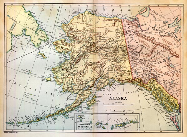
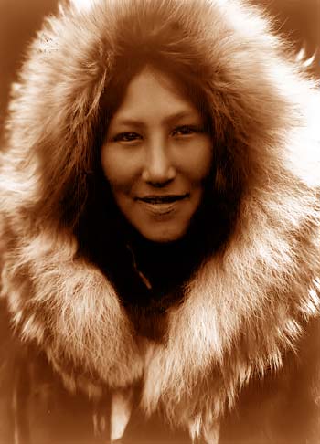
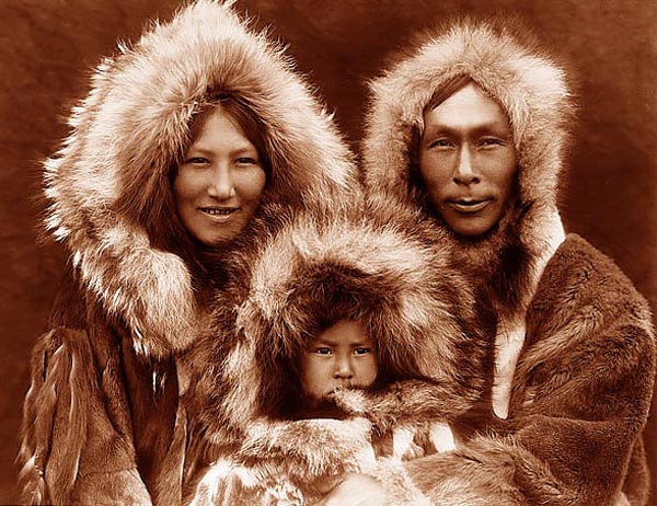
Map of AlaskaClick Here for More Eskimo Pictures
Alaska, an unorganized Territory of the United States, formerly known as
" Russian America "; occupying the region of the extreme northwestern
portion of North America; lying north of the parallel of lat. 50° 40'
N., and west of the meridian of long. 140° W.; also including many
islands lying off the coast; area, land and water
The entire coast - line measures over 4,000 miles, taking into account
the smaller indentations. The climate in some parts is most agreeable.
In the interior are numerous lakes. Its valleys are fertile; its streams
abound with fish and its forests with game; and its islands have
afforded the most extensive and richest fur-seal fishing in the world.
Sitka, or New Archangel, the While it was long believed that the Territory possessed vast riches in minerals, the chief industries were those connected with sealing and salmon-fisheries till about 1895. In that year the United States government organized the first expedition to make a thorough investigation of the mineral properties. The geological survey has since been continued with most fruitful results, and early in 1900 the Director of the Survey completed plans for thorough surveys and explorations by both geological and topographical experts, especially to supplement the important work of his bureau in 1898, and to acquire a fuller knowledge of the remarkable Cape Nome district and its extension in the Seward Peninsula. This work was expected to occupy several years.
As a result of explorations prior to 1900, mining operations on a large scale were undertaken, first in the neighborhood of the boundary-line between the United States and the British possessions, and then, as other fields were disclosed, along the coast section and on some of the near-by islands. During the season of 1899 the last-mentioned region gave indications of outrivalling the famous Klondike and Yukon fields. The rush of miners to the interior fields, and the indiscriminate staking of claims, soon led to a conflict between the American and Canadian miners concerning the boundary-line. Both parties claimed territorial rights to the richest fields then known, and to avoid a state of anarchy that seemed imminent, the United States and the Canadian authorities undertook, first, a separate, and then a joint, survey of the region in dispute. Each party naturally claimed more territory than the other was willing to concede, and, as a result, the delimitation of the boundary was made one of the subjects for determination by the ANGLO-AMERICAN COMMISSION appointed in 1898 for the purpose of negotiating a plan for the settlement of all matters in controversy between the United States and Canada. The commission, after several sessions in Canada and the United States, failed to reach an agreement on the matters submitted to it, and in 1899 a modus vivendi was signed by the representatives of both governments. This agreement fixed the boundary provisionally, and went into operation on Oct. 20. Under the agreement no part of its territory was surrendered by the United States, and none of the rights of either government were prejudiced by it. Modus Vivendi of 1899.—The following is the text of the agreement:It is hereby agreed between the governments of the United States and Great Britain that the boundary-line between Canada and the Territory of Alaska, in the region about the head of Lynn Canal, shall be provisionally fixed, without prejudice to the claims of either party in the permanent adjustment of the international boundary, as follows: In the region of the Dalton Trail, a line beginning at the peak west of Porcupine Creek, marked on the map No. 10 of the United States Commission, Dec. 31, 1895, and on sheet No. 18 of the British Commission, Dec. 31, 1895, with the number 6,500; thence running to the Klehini (or Klaheela) River in the direction of the peak north of that river, marked 5,020 on the aforesaid United States map and 5,025 on the aforesaid British map; thence following the high or right bank of the said Klehini River to the junction thereof with the Chilkat River, a mile and a half, more or less, north of Klukwan—provided that persons proceeding to or from Porcupine Creek shall be freely permitted to follow the trail between the said creek and the said junction of the rivers, into and across the Territory on the Canadian side of the temporary line wherever the trail crosses to such side, and subject to such reasonable regulations for the protection of the revenue as the Canadian government may pre-scribe, to carry with them over such part or parts of the trail between the said points as may lie on the Canadian side of the temporary line such goods and articles as they desire, without being required to pay any customs duties on such goods and articles; and from said junction to the summit of the peak east of the Chilkat River, marked on the afore-said map No. 10 of the United States Commission with the number 5,410 and on the map No. 17 of the aforesaid British Commission with the number 5,490. On the Dyea and Skagway trails, the summits of the Chilkoot and White passes. It is understood, as formerly set forth in communications of the Department of State of the United States, that the citizens or subjects of either power found by this arrangement within the temporary jurisdiction of the other shall suffer no diminution of the rights and privileges which they now enjoy. The government of the United States will at once appoint an officer or officers, in conjunction with an officer or officers to be named by the government of her Britannic Majesty, to mark the temporary line agreed upon by erection of posts, stakes, or other appropriate temporary marks. Alaska in TransitionAfter the United States obtained possession of the Territory the sealing industry was for several years prosecuted with a vigor that led to such a decrease in the number of seals that the government was obliged to enact stringent laws for the conservation of the seals, in order to check the indiscriminate slaughter and prevent the total destruction of the industry. These laws, how-ever, have been constantly violated, with the result that the fur - seal has been nearly exterminated in these waters. Some compensation for this loss has been found in a remarkable increase in the supply of food fishes. Large as was the knowledge of Alaska and its manifold interests and resources that had been acquired up to 1900, much of its vast expanse remained practically an unknown region, depending upon the government surveys then in progress and the resistless pushing forward of gold-hunters for the disclosure of new wonders and material attractions. The entire region on both sides of the boundary-line was in a transition state, and both the United States and the Canadian governments, aided by commercial and religious organizations, were pushing forward, as rapidly as the face of the country would permit, the advantages of civilization hitherto unknown in that bleak region. Early in 1898 an aerial railway was constructed over the Chilkoot Pass to Lake Linderman, a unique enterprise that shortened the time between tidewater and the headwaters of the Yukon River from a month to a day, and removed the perils and hardships of former travels. At the end of that year the first section of the first railroad built in Alaska was completed. This was the White Pass and Yukon Railroad, projected to extend from Skagway to Fort Selkirk. The section ended at Summit, the highest point of the divide. The road was completed through to Lake Bennett in 1899. At the same time the Canadian government had selected five routes for railways in the Yukon region, which it was thought might be provided with sea-coast outlets in the territory of the United States. After the failure of the ANGLO-AMERICAN COMMISSION to settle the boundary contention, a special commission was appointed under a treaty signed in Washington, D. C., Jan. 24, 1903. This body assembled in London on Sept. 3, following, heard final arguments on October 9, reached a decision on Oct. 17, and made its award Oct. 20, granting to the United States all of its contentions excepting that for the Portland Canal, which was given to Canada. The award deprived Canada of access to the sea over a long stretch of coast-line, and of a free passage up the Lynn Canal to the Yukon. |
 surface, 1900, 590,884
square miles; population, according to revised census report of 1890,
32,052; population, according to 1900 census, 63,592; seat of
administration, Sitka. The Russians acquired possession of this
Territory by right of discovery by Vitus Bering, in 1741. He discovered
the crowning peak of the Alaska mountains, Mount St. Elias, on July 18.
That mountain rises to a height of18,024 feet above the sea. Other
notable altitudes, as ascertained by the United States Meteorological
Survey and announced in 1900, are: Blackburn Mountain, 12,500 feet;
Black Mountain, 12,500 feet; Cook Mountain, 13,750 feet; Crillon
Mountain, 15,900 feet; Drum Mountain, 13,300 feet; Fairweather Mountain,
15,292 feet; Hayes Mountain, 14,500 feet; Iliamna Peak, 12,066 feet;
Kimball Mountain, 10,000 feet; Laperouse Mountain, 10,750 feet; Lituya
Mountain, 11,852 feet; Mount McKinley, 20,464 feet; Sanford Mountain,
14,000 feet; Seattle Mountain, 10,000 feet; Tillman Mountain, 13,300
feet; Vancouver Mountain, 15,666 feet; and Wrangel Mountain, 17,500
feet.
surface, 1900, 590,884
square miles; population, according to revised census report of 1890,
32,052; population, according to 1900 census, 63,592; seat of
administration, Sitka. The Russians acquired possession of this
Territory by right of discovery by Vitus Bering, in 1741. He discovered
the crowning peak of the Alaska mountains, Mount St. Elias, on July 18.
That mountain rises to a height of18,024 feet above the sea. Other
notable altitudes, as ascertained by the United States Meteorological
Survey and announced in 1900, are: Blackburn Mountain, 12,500 feet;
Black Mountain, 12,500 feet; Cook Mountain, 13,750 feet; Crillon
Mountain, 15,900 feet; Drum Mountain, 13,300 feet; Fairweather Mountain,
15,292 feet; Hayes Mountain, 14,500 feet; Iliamna Peak, 12,066 feet;
Kimball Mountain, 10,000 feet; Laperouse Mountain, 10,750 feet; Lituya
Mountain, 11,852 feet; Mount McKinley, 20,464 feet; Sanford Mountain,
14,000 feet; Seattle Mountain, 10,000 feet; Tillman Mountain, 13,300
feet; Vancouver Mountain, 15,666 feet; and Wrangel Mountain, 17,500
feet.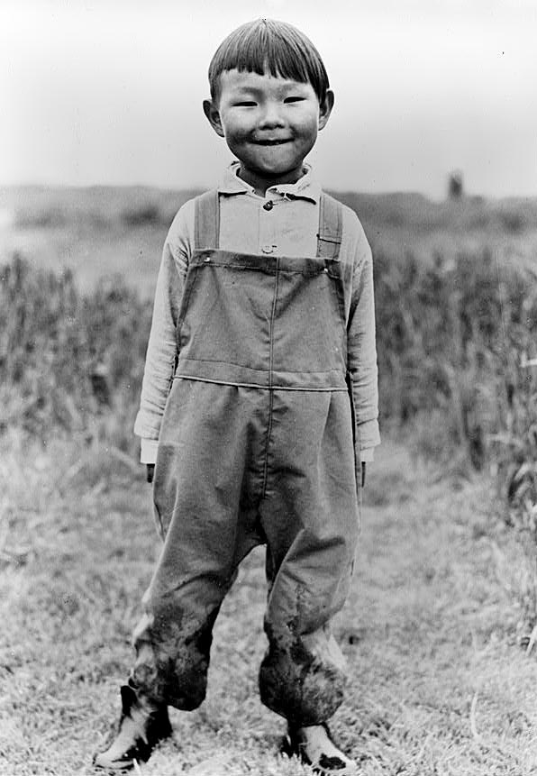
![]()
|
Site Copyright © 2003-2018 Son of the South. For questions or comments, contact paul@sonofthesouth.net. |
|
|
|
Are you Scared and Confused? Click Here to read My Snake Story, a story of hope and encouragement, to help you face your fears. |
||