Republic of Texas Map
![]()
This Site:
The Republic of Texas
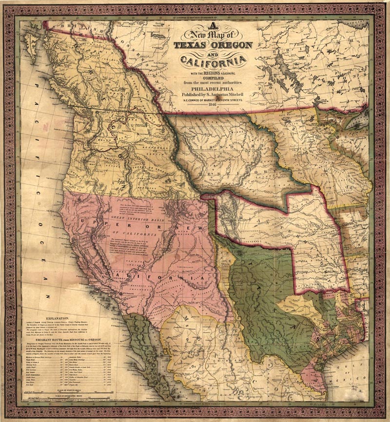
You are viewing a stunning map of the Republic of Texas. The map was created in 1846, and is entitled:
A
New Map of
TEXAS OREGON
AND
CALIFORNIA
WITH THE REJOINS ADJOINING
COMPILED
from the most recent authorities.
PHILADELPHIA
Published by S. Augustus Mitchell
N. E. Corner of Market and Seventh Streets.
1846
The map includes the western part of the Nation, as it was configured in 1846. The map shows the Great Spanish Trail from California to Santa Fe. It also shows the Caravan route from Missouri to Santa Fe.
The map includes an inset with details on the Emigrant Route from Missouri to Oregon. The map describes this as:
"Emigrants to Oregon Territory cross the Rocky Mountains by the South Pass a gap of about 20 miles wide. It is at the head of the Sweetwater a Tributary of the North Fork of the Platte or Nebraska river in Lat 42 25 N and Lon. 32 10 W. From Washington or 109 10 W from Greenwich 950 miles from the mouth of Kansas river and 1174 from the mouth of the Columbia."
![]()
|
Site Copyright © 2003-2018 Son of the South. For questions or comments, contact paul@sonofthesouth.net. |
|
|
|
Are you Scared and Confused? Click Here to read My Snake Story, a story of hope and encouragement, to help you face your fears. |
||