|
This Site:
Discovery of America
The Explorers
Post Columbian Exploration
Thirteen Original Colonies
Colonization of America
Colonial Life
Colonial Days and Ways
Independence Movement
The Patriots
Prelude to War
Revolutionary War
Revolutionary War Battles
Overview of Revolutionary War
Revolutionary War
Timeline
Civil War
American Flag
Mexican War
Republic of Texas
Indians
|
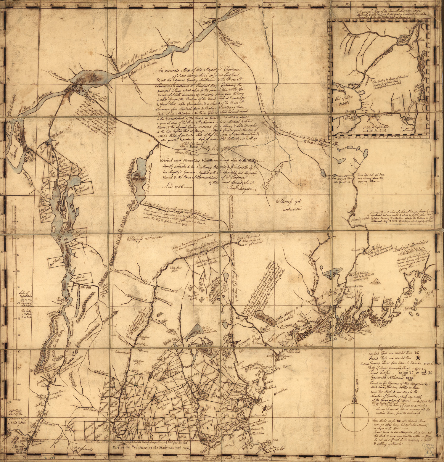
This is an original map created in 1757 which
shows New Hampshire in Colonial Times. The map is labeled, "An
accurate map of His Majesty's Province of New-Hampshire in
New England & all the
adjacent country northward to the River St. Lawrence, & eastward to
Penobscot Bay, containing the principal places which relate to the
present war on the continent of North America. By Samuel Langdon."
The map includes the inscription, "His Excellency Benning Wentworth,
Eqr., His Majesty's Governor," numerous historical and descriptive
notes and inset "A general map of the River St. Lawrence above
Montreal, to Lake Ontario, & the country westward from lake
Champlain to the late English fort at Oswege." The map has
incredible details on terrain, rivers, streams, and other important
landmarks.
|