New Hampshire
|
|
This Site:
|
1757 Map of the New Hampshire ColonyNew Hampshire, COLONY OF,
was for many years a dependent of
Massachusetts. Its short line of seacoast was probably first
discovered by Martin Pring in 1603. It was visited by
Captain John Smith
in 1614. The enterprising
Sir Ferdinando Gorges,
who had been engaged in colonizing projects many years as one of the
most active members of the
Plymouth Company,
projected a settlement farther eastward than any yet established,
and for that purpose he became associated with
John Mason, a merchant (afterwards a
naval commander, and secretary of the Plymouth Council of
New England), and others. Mason was a
man of action, and well acquainted with all matters pertaining to
settlements. He and
Gorges obtained a grant of land (August 10, 1622) extending from
the
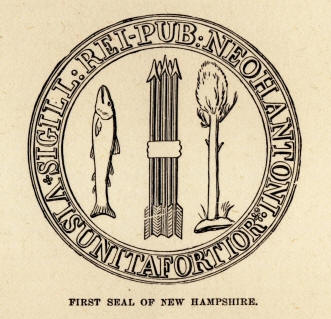
Other fishermen settled on the site of Dover (1623), and there were soon several fishing-stations, but no permanent settlement until 1629, when Mason built a house near the mouth of the Piscataqua, and called the place Portsmouth. He and Gorges had agreed to divide their domain at the Piscataqua, and Mason, obtaining a patent for his portion of the territory, named it New Hampshire. He had been governor of Portsmouth, in Hampshire, England, and these names were given in commemoration of the fact. In the same year (1629), Rev. Mr. Wheelwright, brother of the notable Anne Hutchinson, purchased from the Indians the Wilderness, the Merrimac, and the Piscataqua, and founded Exeter. Mason died in 1633, and his domain passed into the hands of his retainers in payment for past services. The scattered settlements in New Hampshire finally coalesced with the Massachusetts Colony (1641), and the former colony remained a dependent of the latter until 1680, when New Hampshire became a separate royal province, ruled by a governor and council, and a House of Representatives elected by the people. The settlements in New Hampshire gradually extended westward, and until 1764 it was supposed the territory now Vermont was included in that of New Hampshire, and grants of land were made there by the authorities of the latter province. The people of New Hampshire engaged earnestly in the disputes between Great Britain and her American colonies, and they were the first to form an independent State government (Jan. 5, 1776). It was temporary, intended to last only during the war; a permanent State government was not established until June 4, 1784. During the Revolutionary War the people of New Hampshire took an active part. Their men were engaged in many important battles, from that of Bunker Hill to that at Yorktown; and were particularly distinguished for their bravery in the battles of Bennington, Bemis's Heights, Saratoga, and Monmouth. The first seal of New Hampshire as an independent State is represented in the engraving. The tree and fish indicate the productions of the State. Shortly after the treaty of Aix-la-Chapelle (1748), settlements in New Hampshire began to extend westward of the Connecticut River. The territory of New Hampshire had been reckoned to extend, according to the terms of Mason's grant, according only "60 miles in the interior"; the commission of Benning Wentworth, then (1741–67) governor of New Hampshire, included all the territory " to the boundaries of his Majesty's other provinces," and in 1752 he bean to issue grants of lands to settlers west of the Connecticut, in what is now the State of Vermont. New York, by virtue of the duke's patent in 1664, claimed the Connecticut River as its eastern boundary. A mild dispute then arose. New York had relinquished its claim so far east as against Connecticut, and against Massachusetts it was not then seriously insisted upon. Arguing that his province ought to have an extent which would equal that of the western boundary of Massachusetts, Governor Wentworth granted fifteen townships adjoining the recent Massachusetts settlements on the Hoosic. One township was called Bennington, which was in compliment to the governor. Emigrants from Connecticut and Massachusetts began to settle on the domain, when they were checked by the French and Indian War. Afterwards, violent disputes with New York about these grants ensued. See VERMONT. |

 Merrimac
to the Kennebec, and inland to the St. Lawrence. They named the
territory the Province of Laconia; and to forestall the French
settlements in the east, and secure the country to the Protestants,
Gorges secured a grant from
Merrimac
to the Kennebec, and inland to the St. Lawrence. They named the
territory the Province of Laconia; and to forestall the French
settlements in the east, and secure the country to the Protestants,
Gorges secured a grant from |
|
||
|
|
Site Copyright 2003-2018 Son of the South. For Questions or comments about this collection, contact: paul@sonofthesouth.net |
|
|
Are you Scared and Confused? Read My Snake Story, a story of hope and encouragement, to help you face your fears. |
||