New Orleans and Mobile Alabama
![]()
This Site:
Starting a Collection
Top Picks
Online Gallery
Search Page
Order
Winslow Homer
Thomas Nast
Ken Burns Civil War
Original 1861 Civil War Battle Map of:
New Orleans and Mobile Alabama
|
|
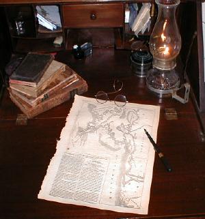
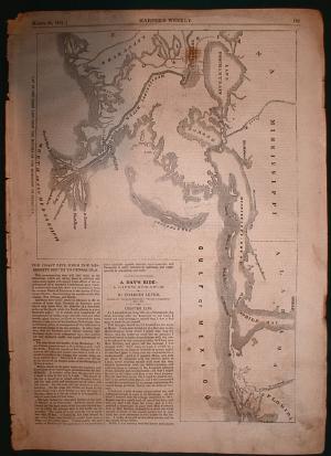
New Orleans and Mobile Alabama Civil War PrintYou are viewing an original 1861 Civil War map that includes New Orleans and Mobile Alabama. It is from an 1861 edition of Harper's Weekly, the most popular newspaper of the day. Note that this is not a reprint, and I absolutely guarantee its authenticity. This print is over 140 years old, and on the date is clearly marked on the front. Original maps from the Civil War are becoming increasingly difficult to find, and this is a nice one. It includes the Gulf of Mexico, and the mouth of the Mississippi River. It shows parts of Florida, Alabama, Mississippi, and Louisiana. The map has a number of landmarks, including Mobile Bay, Pensacola Bay, Fort Pickens, Mississippi Sound, the Pearl River, Lake Ponchartrain and Timbalier Bay. Inset to the side of the map is a fascinating story titled, "The Coast Line From the Mississippi Mouth to Pensacola". The story starts out, "The accompanying map will shed light on the discussions which are taking place in political and commercial circles with regard to the effects of the establishment of a Southern Confederacy upon trade". The story describes the region as it was at the time. This is a great map, and would make a stunning display when framed and placed in your office or study. I assure you that this piece will become the center of attention, and will undoubtedly draw many questions from all who visit. It would make a lovely gift for anyone interested in the Civil War, or anyone living in this region of the country. |
|
|
![]()
|
Email us at: paul@sonofthesouth.net. Copyright © 2003-2018 Son of the South.
|
|
|
|
Are you Scared and Confused? Click Here to read My Snake Story, a story of hope and encouragement, to help you face your fears. |
||