|
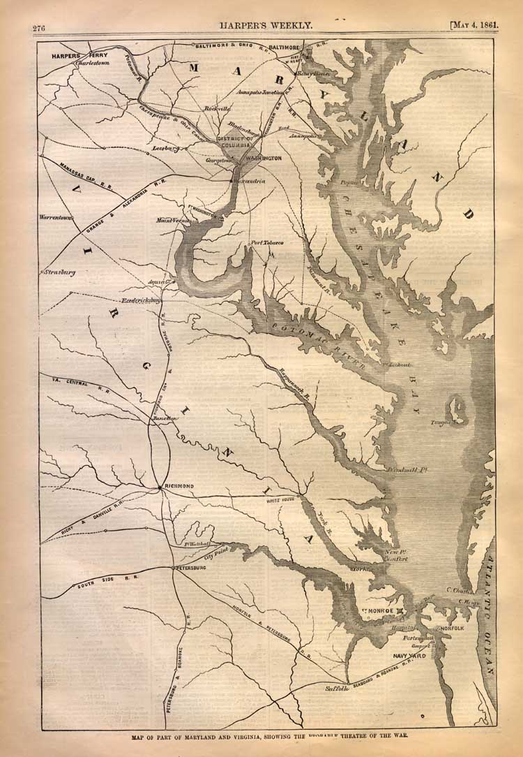
Below we present an original Civil War Map of the
Battle of
Harper's Ferry. The map was printed in May 4, 1861, at the time of the
Battle of Harper's Ferry. The map is captioned "Map of Part of
Maryland and Virginia, Showing the Probably Theater of the War." The
map shows the Norfolk Navy Yard, Suffolk Virginia, the Petersburg and
Roanoke Railroad, The Norfolk and Petersburg Railroad,
Ft. Monroe, the South
Side Railroad, Petersburg,
City Point, the Richmond and Danville Railroad,
Richmond Virginia, White House, the Virginia Central Railroad, the Potomac
Railroad, Strasburg, Fredericksburg, Aquia Creek, the Manassas Gap Railroad,
Washington DC, Georgetown, Leesburg, Alexandria, Baltimore, the Baltimore
and Ohio Railroad line, the Potomac and Chesapeake Canal, and Harper's
Ferry. We acquired this original 140+ year old map
for the purpose of digitally archiving it on this site for your research and
enjoyment. If you would like to obtain this original map, it is
available for a price of $225. Your purchase allows us to continue to expand
the free resources on this site, and allows us to keep this site free of
annoying pop-ups. |