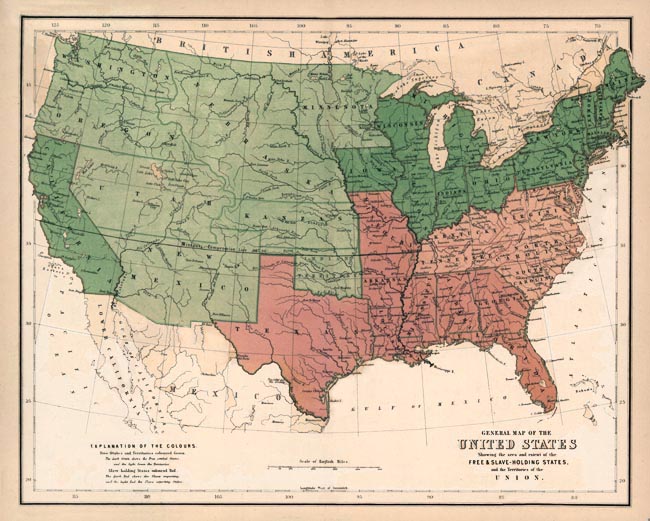
Map of Free and Slave States
![]()
This Site:
|
|
|
This is an original 1857 Map of the United States Showing the Free and Slave States. The Dark green states are the free states. The light green are the free "Territories", which were not yet states. The Red States were Slave Importing States, and the Pink States Were Slave States that Exported Slaves. Part of the dispute which helped trigger the Civil War was how to dispose of the territories . . . would they join the union as Slave or Free? The answer to this would tip the balance of power in the Congress, which is what made it such a difficult issue. |
![]()
|
Email us at: paul@sonofthesouth.net. Copyright © 2003-2018 Son of the South.
|
|
|
|
Are you Scared and Confused? Click Here to read My Snake Story, a story of hope and encouragement, to help you face your fears. |
||